
Rainfall Records “Washed Away”
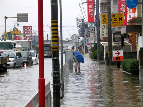
Flooding in Japan (File photo by Rudolph Ammann, CC2.0)
In the last few days, rainfall records were broken in Japan. That was even before the record-breaking typhoon, “Maria”, spun up and is now headed for the region. The deadly flooding in Japan is a reminder that record-setting rainfalls are being surpassed all over the world, almost routinely. At the same time heavy rains in India and Pakistan TODAY, continued almost non-stop, closing schools and businesses. Terrible flood events are becoming common place from Asia, to Europe, India, etc. Of course North America has plenty of examples as well. Just to refresh our memories:
- Ellicott City Maryland – A month ago, 8 inches of rain in 2 hours, literally destroyed the two hundred year-old historic downtown just outside of Washington D.C. It was the second “thousand year rain event” to hit the town in two years.
- Hawaii had over 49 inches in a single 24 hour period, April 15-16, this year – a new U.S. record.
- “Riley” hit New England in March this year with a blizzard of snow and rain – the second deadly “hundred year storm” to hit that area in two months.
- Last fall Harvey, Irma, and Maria dumped record levels of rain over a wide area from the Caribbean to Texas with as much as 40 inches in a few days.
- After 5 years of super drought, in 2017 Northern California had truly deluge floods, from what were described as “atmospheric rivers.”
Easily missed in the headlines and the chaos of weather is that there are some new patterns with storms and rainfall. With hurricanes, the focus has traditionally been almost solely on the wind speed, designated by the “Category of 1-5.” That peak wind speed no longer is a good indicator of the relative damage from the storm. Certainly powerful winds can do a lot of damage, but flooding usually does more damage than strong winds. Often, the worst flooding correlates with slower moving storms have more time to absorb the heat energy and moisture and more time to pound the area with rain, often for days on end. In fact, a new study in the journal NATURE says that tropical cyclones move about ten percent more slowly than they did a half-century ago, with as much as 24 percent more rain with these storms.
The patterns of rainfall and flooding are changing in front of our eyes. Why are we getting extraordinary rainfall and flooding and changing weather patterns? At the risk of oversimplifying, two primary forces are happening year-by-year:
First the oceans are measurably warmer, roughly one and half degrees Fahrenheit, or about one degree Celsius than they were a century ago. Warmer oceans evaporate more moisture into the air. That moisture contains heat energy. The above-normal moisture has to come down as rain – or snow, depending on the local temperature.
 Second, the broad patterns of atmospheric and ocean currents that have been generally reliable following the seasons of the year are changing. Atmospheric currents such as the “jet stream” and ocean currents such as the Gulf Stream have been relatively stable for centuries, even millennia. There are two basic reasons those currents are changing. a) the extra heat in the sea speeds up the motion, just like turning up the heat on a large pot of water on the stove, and b) the melting Arctic Ocean is creating a turbulent sea where there was solid ice. For hundreds of thousands of years, year-round ice, ten feet thick (3 meters) acted as a heat barrier and preventing waves from forming. With that ice rapidly disappearing, the ocean’s heat energy is altering weather patterns locally, changing the Jet Stream, and indirectly altering ocean and atmospheric circulation patterns worldwide.
With these new conditions, we need even better models to predict future flooding, to reduce loss of life and to reduce property losses. Flooding is a combination from coastal storms, heavy rain, downstream “runoff”, extreme tides, and rising sea level. Better flood models will allow us to better plan, design, and build for the future. It is essential that efforts to measure and model the changing patterns have the highest priority, not just in the U.S. but globally. The weather forecasting technology of the National Weather Service (U.S.) part of NOAA has improved over the decades, joined by their international counterparts and the IMO (International Meteorological Organization.) Also in recent decades private companies like The Weather Channel and AccuWeather have been adding to the government weather forecasting, which now extends out to a few weeks quite accurately.
Changing climate – the change in longer term patterns – extends beyond the weather or meteorology timeframe. Longer term rainfall, flood and climate prediction will require even more innovation. Fortunately, there are some new private sector firms working to improve that forecasting. A good example is the start-up, Jupiter Intelligence, recently covered by the New York Times and Washington Post. They are a “Silicon Valley style” enterprise using the latest science, cloud computing and a nimble approach to deliver state-of-the-art projections to both the private and public sector clients. Their target is both more detailed projections as well as longer term models, so they are a welcome new player in the field.
To prepare for and adapt to the new climate era of flooding, heatwaves, and wildfires, we are going to need to utilize all of these tools and technologies. We are entering uncharted territory. Abnormal is the new normal. Record-level weather events keep getting washed away.